Wednesday, 13 September 2017

Stage 5 Ripley - Smelthouses (10 miles)

Wednesday 13th September 2017

Today I walked from Ripley to Smelthouses via Shaw Mills. My intention was to complete The Nidderdale Way today but after taking a wrong turn and spending quite some time getting back on track I decided to end the walk at Smelthouses. The weather was a real mixed bag today - showers, some quite heavy, sunny spells and blustery winds. From Smelthouses I walked the short distance to Low Laithe to catch the bus back to Ripley.


Starting point of today's walk at Ripley.


Nice easy, level walking for the first two miles.


Shaw Mills.


The swallows will soon be heading home.


Very wet paths after the recent heavy rain.


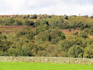
Brimham Rocks in the distance.


A short detour can be made to Brimham Rocks. On this occasion I didn't visit but here are some photos from a few weeks ago.


Stream at Smelthouses.


 Before the drive home I enjoyed a pint of Bad Co. Brewery's Comfortably Numb.


The Boar's Head, Ripley.

Wednesday, 6 September 2017

Stage 4 Birstwith - Ripley ( 6 miles )

Wednesday 6th September 2017

I drove to the starting point at Birstwith and walked along the banks of the Nidd to Hampsthwaite. From there it was all uphill to Clint Bank and then along a bridleway through Hollybank Wood all the way to Ripley. Got a bus to Harrogate and from there another bus back to Birstwith. Enjoyable walk on a fine day. Didn't have time for a pint today !


Hampsthwaite.


Map at Hampsthwaite.


 Looking back at Hampsthwaite from Clint Bank.


Hollybank Lane.


Bedlam ? Been there a few times.


Hollybank Wood.


Ripley Castle, built in 1345, has been the seat of the Ingleby family for centuries.


Ripley Lake.


Ripley Town Hall.


Market Cross and village stocks at Ripley.


I had never seen a black pheasant before but saw many on today's walk.

Friday, 1 September 2017

Stage 3 Bewerley - Birstwith (12 miles)

Thursday 31st August 2017

I parked the car at Pateley Bridge and walked the mile or so to the starting point at Bewerley. Soon took a wrong turn and ended up going up through Guisecliff Wood and backtracking to Yorke's Folly past Guise Cliff, adding 2 miles to the walk. From Yorke's Folly it was a steep descent to the River Nidd. Then followed two and a half miles of walking on the banks of the River Nidd, through Dacre Banks to my finishing point at Birstwith. I then got the bus back to Pateley Bridge. Lovely walk on a lovely day.


Hold up at Bewerley.


Yorke's Folly, known locally as "Two Stoops", is a pair of stone pillars styled as if to appear as if part of a ruined arch, though in truth they remain almost fully intact from their original construction, though originally there were three stoops, the third having collapsed during a storm in 1893.
The folly was built during a time of hardship and low employment, as was common to the Victorian era the building of the folly allowed the wealthy Yorke family to provide paid work and food to needy workers.


Crocodile Rock on Guise Cliff.


The "golf balls" at Menwith Hill in the distance.


Apparently, you can can hire a llama to carry your bags along The Nidderdale Way.


Stopped for a pint of Jennings' Cumberland Ale at The Royal Oak in Dacre Banks.


Signpost at Summerbridge.


  I think Pippa enjoyed her drink in The Nidd as much as I enjoyed mine in The Royal Oak.


Unfortunately, Himalayan Balsam, an invasive species, has completely taken over on the banks of The Nidd.


The Pateley Bridge to Harrogate railway line, opened in 1862 was closed to passenger services in 1950 and goods services in 1964.


 The River Nidd.


The Nidd at Birstwith.


How convenient that there was a pub where I could enjoy a pint of Bradfield Brewery's Farmer's Brown Cow whilst I waited for the bus.